Sunday, July 10, 2016

Running Out to Rum

Even though we still have lots to do in preparation for our upcoming 16-day trip to Hesquiat, Robyn and I decided to join Kari and her friend Rhea for a paddle out to Rum Island today that we put together late last night.

Perfect conditions consisting of sun with a few clouds, light winds until later in the day and just a bit of current to contend with on the way back in. Launching out of Amherst Beach at 8:30am our route took us past Dock Island, between Sheep and Domville Islands and over to Gooch Island where Robyn and I rolled to cool off a bit. We did manage to spot several flocks of Heermann's Gulls, a family of Oyster Catchers with two young (no orange bills yet), Cormorants, Bald Eagles, Turkey Vultures, Rhinocerus Aulets and lots of Canada Geese.

It was just after 10:00am when we arrived at Rum Island seeing another couple just departing with them commenting that we had the whole island to ourselves. Nice but we didn’t bring our camping gear…. again!

Love Rhea's color coordination!!

Kari, Mark and Rhea on the east side of Domville

We decided to check out the camping area and the first thing I noticed was how rough the 3 tent pad areas looked. After just coming back from the pristine San Juan Islands, the Parks Canada Gulf Island National Park Reserve (GINPR) on Rum Island sure could use a little maintenance especially around the tent pads, trails and the picnic tables that need to be repaired or replaced. It’s really sad that our federal government doesn’t allocate enough funds to maintain the GINPR properly yet they promote the National Park system as being one of the best in the world.

Looking a little worn out ... the camp area could use some attention.

Since it was too early in the day to have lunch we hiked around the small island finding it difficult to locate the rough trail at times but never the less we made it to Tom Point and watched a couple of huge container ships rounding Turn Point towards Vancouver. In the distance, the San Juan Islands no longer looked like some uncharted land since we recently paddled and camped throughout the islands.

Big freaking cargo ships passing between Rum Island and the San Juan Islands.

Checking the tide and current data we thought about making a run towards Mandarte Island to check out some of the many bird species that nest there and then over to Sidney Island. However, with an increasing ebb flow we decided that trying to make it around Sidney Spit might be difficult and opted for a return route via Dock Island where we would have lunch.

Lots of laughs today and a few jabs at Kari to keep her smiling LOL

The ebb flow was beginning to build as we hugged the south shoreline of Gooch Island and west shoreline of Domville Island letting a back eddy pull us along. We did have to do a little ferry angle paddling to reach Dock Island but once there enjoyed lunch in the sun and watched how the currents changed by the minute through the little islets.

Dock Island lunch stop.

Paddling back towards Little Shell Island was uneventful but the crossing back over towards Amherst Beach became a bit lumpy as unpredicted SE winds came up fast to interact with the ebb flow creating small white caps. Still, it was another great day to be on the water in our kayaking playground close to home.

Next up …. Off to Tofino on Thursday to go off the grid for 16 days paddling on the west coast.


2016 Paddle #26 - Rum Island
Distance: 11.19 nm (20.72 km)
YTD: 238.91 nm (442.32 km)

Saturday, July 9, 2016

San Juan Expedition Part 2

Turning the Corner (Blind Island to Clark Island) - Sunday May 1st (Day #3)

After a fitful sleep on Blind Island due to our site not being level we woke up to another day of sunshine and no winds. Our plan was to be on the water by no later than 9:00am and head east through Harney Channel towards Obstruction Pass 4nm in the distance. We really didn’t have a particular camping destination planned for today but knew that there were a couple of sites to check out before we would turn the corner at Lawrence Point towards Clark, Matia, Sucia and Petos Islands.

Leaving Blind Island only the Washington State Ferries were on the water with us this morning.

Lynn and Michael as a ferry leaves Orcas Island

Other than several Washington State ferries crossing between the islands there wasn’t any marine traffic to speak about as we crossed East Sound and located the state recreation site just before Obstruction Pass. Feeling pretty good about ourselves Michael and I got into a rendition of the theme from Gilligan’s Island and the wreck of the S.S. Minnow just as we about to land at the state park. Sure enough I ran up onto a rock and heard an unfavorable cracking sound somewhere below the waterline of my kayak. Karma?? 

The beach at Obstruction Pass park

After the rest of group landed I rolled over my fully loaded kayak for a quick inspection and thankfully saw no signs of damage. I came to the conclusion that it probably was a few barnacles that I crunched while running aground. In any case I would do a proper inspection at our next camp location hoping that my front hatch wouldn’t be taking water on.

The Obstruction Pass park is situated high above the water on a bluff with campsites nicely spaced offering views of Lopez Island and the Olympic Mountains in the distance. If it wasn’t for San Juan Island blocking our view, we would have been able to see Victoria only about 18nm SW from this location.

Great view of the Olympic Mountains in the distance.

Since it was still early in the day we decided to take advantage of the last of the slack and make our way through Obstruction Pass towards the next possible campsite located on Doe Island about 3nm NE of us. While paddling through the pass, which was starting to show the beginning of an ebb flowing against us, we came across several NDK kayaks playing in the rock gardens and sure enough we discovered they were part of a group from Body Boat and Blade, Eastsound, Orcas Island.

Leaving Obstruction Pass we spotted a few tankers in Rosario Strait as we were carried on a back eddy towards a campsite situated in Doe Bay. The Doe Island State Park has limited landing areas due to the steepness of the island but does have a few primitive campsites facing south east. We decided to make this our lunch stop and press on towards Clark Island to make camp for the night.

Lunch stop on Doe Island

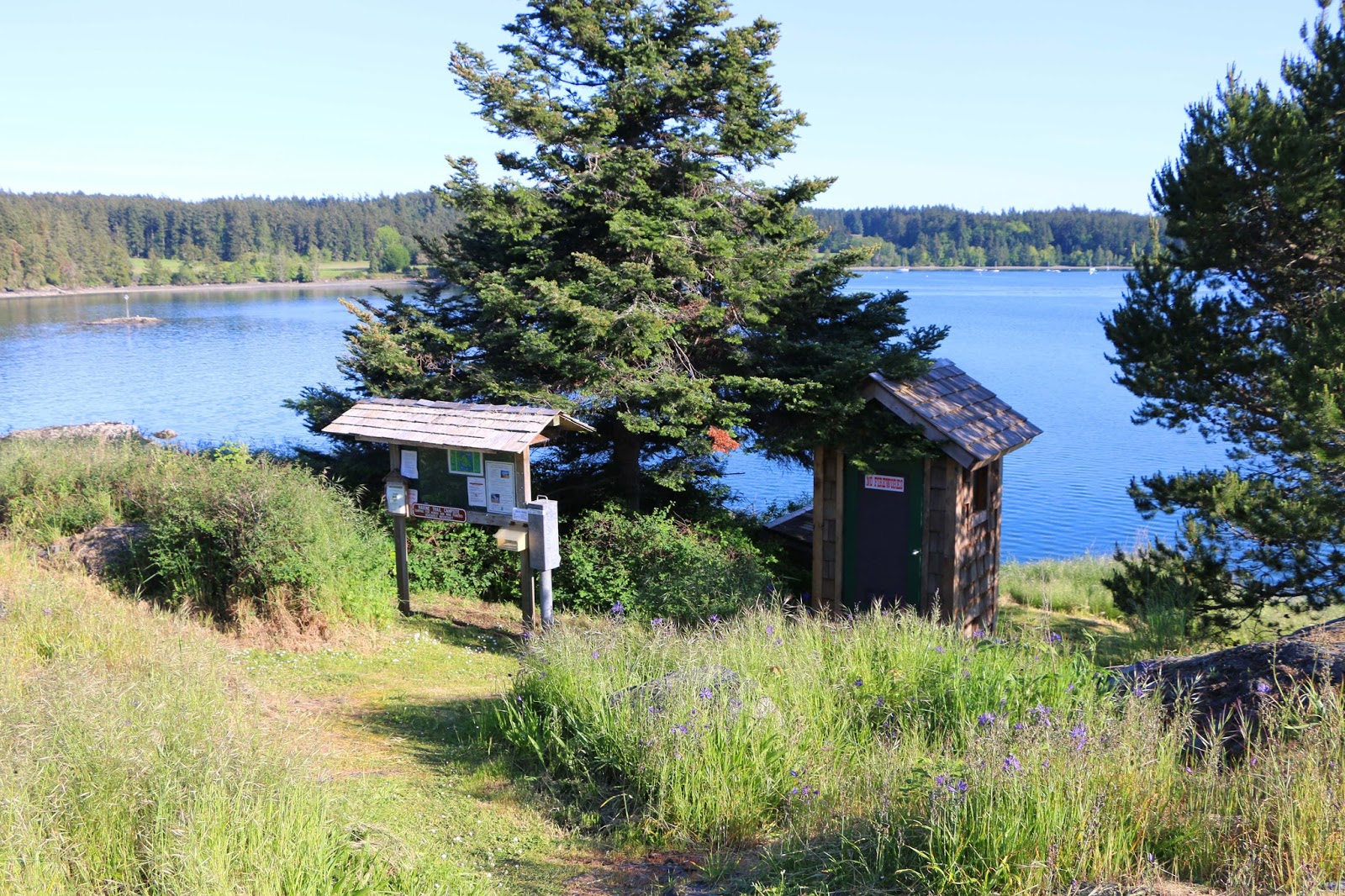
As we approached Lawrence Point we noticed that the water was very confused as a number of power boats were coming close to the headland churning up the water. Rounding the point, we were a little surprised to feel a very brisk NW headland wind which, combined with current, created a bit of a rip tide. A couple of sea lions seemed to enjoy playing in the waves as they swam around and under us as we tried to punch through the confused water. For several minutes we made absolutely no head way at all and the thought crossed my mind a few times that we might just have to head back to Doe Island for the night. Once we moved away from the point we slowly started making progress towards Clark Island but it was a slog to say the least taking over two hours to make the 2nm transit from Lawrence Point. It was a long day on the water as we finally landed at the campground a few minutes before 4:00pm and went to work setting up camp on the smooth gravel beach facing east.

That evening we decided we would head towards Matia Island in the morning but would give ourselves a later start as the forecast was favorable and we could take advantage of the currents. From our campsite on Clark the view of Mt. Baker was spectacular but there was a constant drone of noise coming from what we thought was the Cherry Point refinery on the mainland USA.  As the sun set we watched the Seattle to Alaska ferry heading north and then a huge oil tanker heading south towards Rosario Strait.  Oh, yeah ... the outhouse is typical of many of the Washington State Parks we visited. Pretty nice huh?

Clark Island camp on the beach

Our view from the beach of Mt. Baker at sunset ... stunning!!


2016 Paddle #19 - Blind Bay Island to Clark Island
Distance: 14.59 nm (27.02 km)
Trip: 40.54 nm (75.08 km)
YTD: 145.89 nm (270.18km)


Emerald of the San Juan's (Clark Island to Sucia Island) - Monday May 2nd. (Day #4)

We woke up to brilliant sunshine and no wind and the ever present constant drone from Cherry Point. Since we were waiting for the slack time, Michael headed out to explore the island a bit while Robyn, Kari and I went searching for a couple of geocaches and the group sites that were supposed to be around here somewhere. As we were zeroing in on our first cache we came across the group sites located at the southern tip of the island nestled in the forest with views southeast towards Lawrence Point. 

Good morning from Clark Island

And yes we even found some geocaches on the trip. Kayaking Kare Bear and RVTraveller

Just after 10:00am we were on the water heading towards Matia Island in absolute glassy conditions. We managed to spot a few porpoises along the way and a number of sea birds such as rhinoceros auklets, guillemots and gulls. Receiving a gentle flood push we completed the 4.5nm transit to Puffin Island just off the south end of Matia in less than 2 hours but sadly didn’t see any puffins at this time of year.

Perfect conditions heading towards Puffin and Matia Islands

Michael checking the rocky slopes of Puffin Island.

The terrain of both Puffin and Matia Island was very steep making landing virtually impossible except for Rolfe Cove on Matia where the campsite is located. We decided to check out the campsite which faces NW and found that even by noon it was just starting to receive sunlight on the beach. The campsite itself is nestled just above the beach in the forest but we felt that we would be better off heading towards Sucia Island only 1.5nm in the distance rather than spending a night here.

Looking like several islands, Sucia Island consists of many fingers of land and a few smaller islands.

Paddling towards Sucia from the SE you realize how expansive the island is with its many bays, finger islands and noted 10 miles of hiking trails. As we approached the island we decided to head along the west side of the island towards the Shallow Bay campsites but as we got closer to Fox Cove we could see a campsite situated on a grassy tombolo. We paddled into Fox Cove which is protected from the open water and after checking out the campsites there decided that this would be our home for the next couple of nights. It didn’t take long for us to discover that Sucia was indeed the emerald of the San Juan’s with over 60 mooring buoys, dock facilities for pleasure craft, over 60 campsites situated all over the island and several fossil beds which we explored. 

The Fox Cove campsite on the tombolo just ahead and nobody was there!

Paddling into Fox Cove

We set up camp in a site that had to be at least 75’ x 75’ and at bargain price of only $12 for all 5 of us. As the day progressed we checked the forecast and although it was sunny it was calling for possible thunder showers later in the evening so just as a precaution we set up our tarps in the warm sunshine. Later in the evening the clear skies started to give way to clouds rolling in from the west and it wasn’t long before we heard the rumblings of thunder somewhere in the Cascade foothills as we sat around the campfire. Just before bedtime that we felt the first raindrops. There’s something magical about listening to rain falling while you're bundled up in your tent.


Yup ... all this for $12 per night for up to 8 people.

Collecting driftwood for our fire later in the evening.

The clouds start to arrive as the sun starts to set.

Who brought the marshmallows?? 


2016 Paddle #20 - Clark Island to Sucia Island
Distance: 9.40 nm (17.40 km)
Trip: 49.94 nm (92.48 km)
YTD: 195.83 nm (362.67km)

Note: More pictures of the entire San Juan Islands trip can be found by following the link HERE

Monday, July 4, 2016

San Juan Expedition Part 1

Heading Out (Sidney to Roche Harbour)- Friday April 29th (Day#1)

The San Juan Islands .... so close to home but why is it that we haven't heard of many people going there by kayak? Robyn and I got talking with Kari Challenger and we thought why not, let's do it so we put the word out that we were going and Lynn Baier and Michael Egilson decided to join our little paddling expedition at the end of April.

Only a mere 3.5 nm crossing from Rum Island (Canada) to Stuart Island (USA) the San Juan Islands were just too tempting for us to pass up. Maybe it's the fact that the border is involved and you have to paddle to the nearest customs location and possibly run the risk of having all your dehydrated foods confiscated. Maybe its the fact that to get there you have to cross a major shipping channel dodging 900 foot freighters and oil tankers not once but twice if you plan on coming home. Maybe it's the fact that you can't simply land where ever you want to because the land owners have property rights right to the water line. Maybe its the fact that we heard there are lots of currents there. Maybe its the fact that we would have to drink American beer and wine. LOL

Packing the kayaks at Van Isle Marina

Our little band of 5 paddlers launched out of Van Isle Marina at 06:45am to try and take advantage of a double slack that was being predicted for the morning. You see, if there was going to be a game of Frogger with big ships in the shipping channel we thought no currents would be in our favor to get a high score. Oh yeah I forgot to mention ... none of us had ever been there before either so we were really being explorers venturing into uncharted territory. But at least we had a couple of charts. LOL

To get there we decided that we would leave Sidney and head to Rum Island which would be our "Go, No Go" decision point before making the short run across to Stuart Island. After checking the Marine Traffic app on my iPhone and saw no big ships for miles and mile and miles we made the decision (08:30am) to press on towards the USA. Talk about anticlimactic! No big ships edging hard around Turn Point towards us and nothing heading our direction from Discovery Island.

The paddle into US waters was totally uneventful and it felt more like crossing over to Sidney Island from Sidney except we needed to find where Roche Harbour was on San Juan Island to check into customs. Remember, no landing until clearing customs..... even for a pee break! Checking our charts we could see where the entrance to Roche Harbour should be so we adjusted our course to paddle past a small islet called Battleship Rock and then we experienced our first taste of San Juan Islands currents. From a distance I started to notice that we weren't making very good progress towards the rock and no sooner had I figured that out I noticed the increasing ebb current flowing around the island. So it was early into our expedition that we got to experience how the water moves to and from the Georgia Basin through the San Juan Islands.

Arriving just a little bit behind schedule we paddled into Roche Harbour past spectacular waterfront homes some with their own de Havilland Beavers tied up to their docks and started searching for the customs dock. We had heard about Roche Harbour being a get-away destination and it was obvious by the multi million dollar yachts in the marina. Robyn had done a little recon the week before and actually called the US Customs Office at Roche Harbour and found out that we had to check in no later than 11:30am before they closed for a couple of hours.  

We located the Harbormasters building and managed to climb out of our kayaks at 10:45am onto the dock which was about 3 feet above us. There was a sense of accomplishment having paddled from Canada to the USA even though it is a relatively short crossing and not having big ships issues.


Tied up and waiting to clear customs

We let Robyn make the call to the US Customs using one of the dedicated telephones on the outside of the Harbormaster building. We were in luck as Robyn spoke to the young lady that she spoken to a few days earlier and before we knew it the young lady came down to the dock to check our passports. Looking like a group of honest kayakers (which we are) there was no checking our kayaks or even our dehydrated food that we brought with us. We each received a US clearance number just in case anyone asked us for proof of being allowed in the US and then it was time to get some much needed supplies ..... beer and wine!!!

Robyn makes the call to US Customs to let them know we are on the dock. 

The harbormasters office told us where we need to move our kayaks to before heading to the Roche Harbour Lime and Cement Co. general store for provisions. After picking up some fresh essentials such as fruit, soda, beer, wine and only one bag of Lays chips we headed to Posey Island State Park that we had passed paddling into Roche Harbour.

The one thing I regret is not exploring the town of Roche Harbour but we needed to get to Posey Island to ensure that we had a campsite to stay at. Posey Island is a small, one-acre marine camping park with 1,000-feet of shoreline for the exclusive use of boaters arriving by human or wind-powered watercraft.

Most of the state marine parks can be reserved ahead of time but we were visiting the San Juan Islands two weeks before reservations could be made so we just had to hope for the best at every place that we would make camp. Fingers crossed.

The campsite from the water. A very beautiful place to spend our first night

We landed on Posey just after 1:00pm and were totally blown away by how well maintained it was. Being a very small island it only has two available campsites (both empty) which can have a maximum of 8 persons each but there are no designated tent areas other than the abundant freshly cut grass to set up camp. The island also has a very clean and well stocked composing toilet and our first impression of the state park was pretty good. The other thing to note is that each campsite has a fire ring and the parks promote burning driftwood. Best yet ... the whole campsite is only $12 per night. What a great place to make camp after an early start to the day.


Does a campsite get any better than this???

We spent the rest of the day just taking it easy, planning for our next day of paddling and hiking around the island which took maybe a whole 10 minutes if you were lucky. The forecast for the next several days was warm temperatures and nothing but sunshine.

Sunset over Vancouver Island.

Talk about getting lucky with late April early May weather!! We watched the sun set over the Gulf Islands and it was just after 8:30pm when we all climbed into our tents. It was a great day 1.


2016 Paddle #17 - Sidney - Roche Harbour
Distance: 13.13 nm (24.31 km)
YTD: 118.48 nm (219.42 km)


Exploring (Posey Island to Blind Bay Island) Saturday April 30th (Day#2)

Just before sunrise on day #2

Robyn and I were up early 5:30am on day 2 and oh my what a beautiful sunrise that was greeting us as we climbed out of our tent. Our plan for the day was to be on the water for 9:00am so that we could take advantage of the slack in San Juan Channel which would be our only major (2nm) crossing for the day.  Keeping in mind that we had never been here before and we were trying to avoid any potential water features marked on the chart like whirlpools and standing waves. Arriving at Limestone Point we were relieved to see nothing but calm water and a couple of Washington State ferries heading down towards Friday Harbour in the south.

Our first port of call was the north campsite on Jones Island State Park. We paddled into the sheltered cove that had a dock with pleasure craft tied up. Landing on the nice gravel beach we explored the campsite that was once again beautifully manicured with two composting toilets and several campsites. We stopped to talk to the pleasure craft owners who were all middle aged men belonging to a group known as the Dogfish Derby fishermen. They actually didn't do any fishing anymore but instead their annual gathering was more of a "man party" for the weekend and they kindly warned us if we were going to stay here for the night it might get a little loud. LOL

We had other plans anyway so we headed on our way to the south end of Jones Island in our kayaks even though we could have walked the half mile trail through the middle of the island. Arriving at the south Jones Island State Park we found a beautifully manicured expansive grassy meadow and several Adirondack huts that could be used (and reserved) and lots of space to set up camp. We were now begining to see the pattern of how well the Washington State Marine Park system is maintained and operated and something our Gulf Islands National Parks Reserve should considering looking at as an operating model.

The beach at the Jones Island south campsite.

A beautifully manicured meadow with several campsites around the perimeter

Less than a mile south from the park we could see a very green grassy looking island and by checking our handbook (Kayaking Puget Sound and the San Juan Islands) we found out that it was called Yellow Island which is a Nature Conservancy. I could envision how yellow it could become during the summer months. We headed towards it to do a little exploring carried along with the presence of a gently building ebb. The island has limited access, no camping or restroom facilities and is open to the public to visit from 10:00am to 4:00pm year round. Another regret of not stopping to spend some time on the island but that will have to wait for another trip as we need to make way towards our next overnight location in Blind Bay 5 nm east.

Our route took us past Cliff and Crane Island and then we followed the northern shoreline of Shaw Island against a building ebb until we reached Blind Bay and our next campsite on Blind Island at 2:00pm. From a distance the Blind Island State Marine Park didn't look anything more than a steeply sided mound rising out of the bay but once we got a bit closer we could make out a few picnic benches. The 3-acre island is located off Shaw Island near the entrance to Blind Bay and is part of San Juan Islands National Monument, which was created in 2013. It has about 1,280 feet of shoreline but due to the steepness you can't really walk along the waterline.

Searching for a place to land we located a small rocky landing area (not really a beach) on the west side and took turns landing and lifting our kayaks up onto dry land so that they could be unloaded. Once again we had the whole island to ourselves and after checking out the several campsites we settled on site #2 because it was the largest and flatest site on the island. However, each site nestled in the tall grass was manicured beautifully, each with a fire ring and very clean composting toilet all for $12 per night for up to 8 persons.


Not your average outhouse. Very clean, well stocked and some even had tile floors!!

We unloaded all the gear that we would need and Michael and I decided to make a run across Harney Channel to the town of Orcas less than a half mile away. After a nice afternoon of relaxing on Posey Island the day before, Michael and I did a little math and figured out that our beer supply might not make it before the trip was over so off we went to get more provisions. 


Enjoying the sun on top of Blind Island

The view to the west from the top of  Blind Island

After dinner we explored the little island, lit a small fire in site #1 and watched the sun set on our day 2 adventures. Tomorrow our plan was to be on the water at 09:00am and head further east around the bottom of Orcas Island.


2016 Paddle #18 - Posey Island to Blind Bay Island
Distance: 12.82 nm (23.74 km)
Trip: 25.95 nm (48.06 km)
YTD: 131.30 nm (243.16km)

Note: More pictures of the entire San Juan Islands trip can be found by following the link HERE 

Friday, July 1, 2016

Canada Day at Pedder Bay

WOW!! 6 weeks since the last time we were on the water. I guess after 5 years of paddling almost every other weekend I think we deserved a bit of an unplanned break. During the down time we have done a little RV'ing, spent a weekend in Vancouver and done a fair bit of hiking while combining geocaching and bird photography / watching which has become a passion of ours.

If you are on Facebook you can check out some of my photographs by following this LINK

This weekend we are back at Pedder Bay RV Resort for a 4 day super long weekend and although we have been experiencing high winds of +35 kts since Friday night we did manage to paddle on July 1st Canada Day. Our original plan was to simply get on the water and play for about 30 minutes but after putting in some really good rolls we took advantage of the early calm conditions and headed out towards Bentinck Island.

It felt great to be back on the water blending strokes while interacting with nature and identifying the creatures above and below the surface. Sometimes taking a break from something your love to do helps re-energize the soul. Yup ... we're back!!


2016 Paddle #25 - Pedder Bay Canada Day
Distance: 6.17 nm (11.42 km)
YTD: 193.34 nm (358.06 km)